The Geography of Isolation: How OBX Survived Before Bridges
Long before vacation homes, rental weeks, and GPS directions, the Outer Banks existed on the edge of the map.
Published
Long before vacation homes, rental weeks, and GPS directions, the Outer Banks existed on the edge of the map. A thin chain of barrier islands stretching more than 100 miles along the coast of North Carolina, the Outer Banks (OBX) were once separated from the mainland not just by water, but by weather, shifting inlets, and sheer uncertainty. Before bridges connected the islands to the rest of the state in the 20th century, life here depended on boats, ferries, and a deep understanding of the sea. The geographic isolation shaped culture, survival, economy, and identity.
Here’s how OBX endured and even thrived before the bridges arrived.
A Coast That Refused to Stay Still
The Outer Banks are barrier islands, dynamic landforms built from sand, constantly reshaped by tides, storms, and longshore currents. Inlets would open during hurricanes and close again over time. Shorelines moved. Entire villages relocated to escape erosion. For centuries, access from the mainland meant navigating shallow sounds like the Albemarle and Pamlico or crossing unpredictable inlets by small boat. There were no highways and no causeways. The geography itself enforced independence. Even as late as the early 1900s, travel between villages such as Hatteras, Ocracoke, and Roanoke Island could take hours by skiff or sail. Storms could cut communities off for days or weeks.
Water Was the Highway
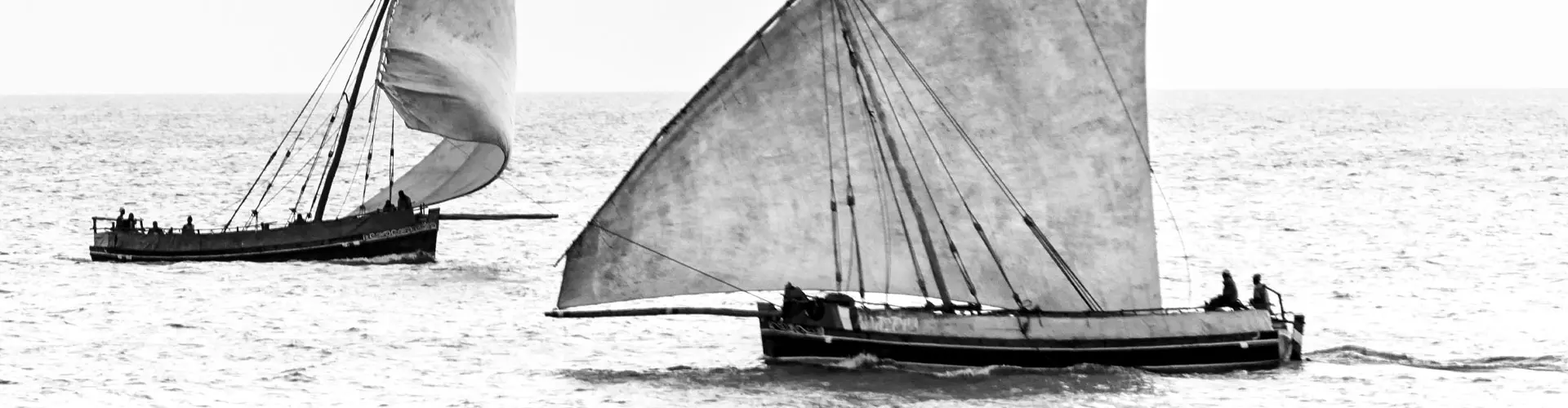
Before bridges, boats were lifelines. The shallow inland waters behind the islands, the Albemarle Sound and Pamlico Sound, functioned as the region’s primary transportation corridors. Small sailboats known as “sharpies” were common workboats, designed specifically for shallow draft waters. Mail arrived by boat. Supplies came by boat and doctors traveled by boat. By the 1920s and 1930s, small ferries began operating more regularly between the islands and mainland towns like Manns Harbor and Stumpy Point. These early ferries were often wooden vessels, subject to weather and mechanical limits. According to records from the North Carolina Department of Transportation, North Carolina began operating a formal ferry system in 1947. The ferry division remains one of the largest state-operated systems in the U.S. today - a legacy of those isolated years. Even now, ferries remain essential for Ocracoke Island, long after bridges connected much of the OBX.
Shipwrecks and Survival
Isolation also meant danger, particularly along what became known as the “Graveyard of the Atlantic.” The waters off Cape Hatteras are infamous for shifting shoals and colliding currents. Since the 1500s, thousands of ships have wrecked here with the Graveyard of the Atlantic Museum records documenting more than 2,000 shipwrecks lying off North Carolina’s coast.
To combat this danger, the U.S. established a network of Life-Saving Stations in the 19th century. These stations, precursors to the modern Coast Guard, were strategically placed along the Outer Banks. Surfmen stationed there would patrol beaches on foot, often in brutal weather, scanning for shipwrecks. When disaster struck, they launched wooden rescue boats into pounding surf. These communities protected strangers from the sea while remaining largely cut off themselves.
A Distinct Culture Emerged
Geographic separation gave rise to a distinct cultural identity. Many Outer Banks families can trace their lineage back centuries. Due to limited migration and relative isolation, linguists have long studied the unique dialect known as the “Hoi Toider” brogue, particularly on Ocracoke and Hatteras Islands. The accent carries echoes of early British settlers. While it has faded in recent decades due to tourism and connectivity, it remains a symbol of OBX heritage. Fishing and boatbuilding dominated the local economy. Families worked together harvesting mullet, shad, oysters, and blue crabs. During the late 19th and early 20th centuries, commercial fishing was the economic backbone of the region. Even duck hunting clubs, established by wealthy mainland visitors in the late 1800s, depended on the expertise of local watermen to navigate the sounds.
The Turning Point When Bridges Arrived
Everything changed in the 1930s and 1960s. The first major breakthrough came with the construction of a bridge from the mainland to Roanoke Island in the late 1920s. Later, the completion of the Herbert C. Bonner Bridge over Oregon Inlet in 1963 permanently connected Hatteras Island to the northern Outer Banks by road. (That structure was replaced in 2019 by the Marc Basnight Bridge, a modern 2.8-mile span designed to withstand coastal forces.)
Road access transformed the OBX from a remote maritime region into a growing tourist destination. By the 1970s and 1980s, rental cottages multiplied. Year-round populations grew.
Isolation gradually gave way to accessibility.
What Was Gained and What Was Lost
Bridges brought economic opportunity, medical access, and education improvements. They reduced the risk of being cut off during storms (though hurricanes still isolate sections of the islands at times). But they also changed the rhythm of life. Where once communities relied almost entirely on neighbors and local skills, outside supply chains became routine. Tourism overtook commercial fishing as the dominant economic driver. The population of Dare County, which includes much of the Outer Banks, has grown significantly over the past century. According to U.S. Census data, the county’s population increased from fewer than 6,000 residents in 1940 to over 36,000 by 2020.
However, isolation isn’t entirely gone. Despite modern bridges, the geography still asserts itself.
Hurricanes routinely close Highway 12. Inlets continue to shift. Nor’easters flood roads. Ferry routes remain essential to Ocracoke. And during major storms, residents sometimes experience a glimpse of the past, when the islands feel separated again.
Understanding how OBX survived before bridges explains why resilience runs deep here.
The communities that developed in isolation learned to adapt to storms, to shifting sand, to limited resources. That adaptability still defines the region. When you drive across a modern bridge into the Outer Banks, you’re crossing into a place shaped by centuries of separation, survival, and self-reliance. Before highways and rental check-ins, there were small boats, surfmen, watermen, and families who built lives on a narrow strip of sand. And in many ways, that spirit still anchors the Outer Banks today.